Uganda Travel Destinations
BWINDI IMPENETRABLE NATIONAL PARK
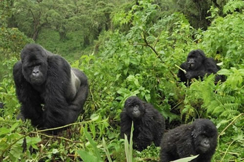 This dense, misty forest with a varied topography is ideal for observing mountain gorillas. Bwindi Impenetrable National Park is located in southwest Uganda on the rim of the Rift Valley. This biologically diversified forest, which encompasses 331 square kilometers, is one of East Africa's greatest Afromontane forests.
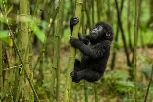
Its varied vegetation creates a dense thicket that makes it impenetrable. As a result, it was given the moniker "impenetrable." This peculiar habitat is well-known for housing around 300 Mountain gorillas. They are believed to account for over half of the world's population, earning them the designation of 'endangered species.' For the same reason, the National Park was named a UNESCO Natural World Heritage Site in December 1994, three years after its formation.
QUEEN ELIZABETH NATIONAL PARK
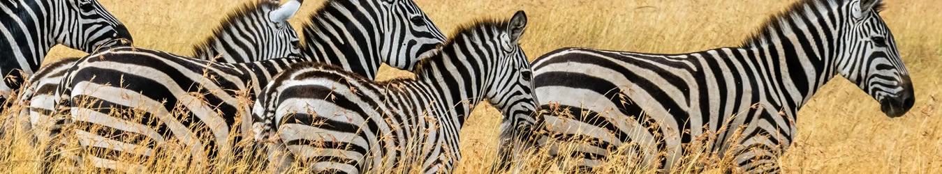
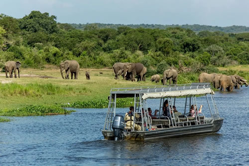
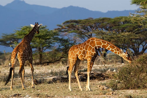 Queen Elizabeth National Park, located west of Uganda, is the nearest attraction to Kampala, only 157 kilometers away. The driving duration should be around 3 hours. At 1,350m above sea level, the Katwe explosion craters are the park's highest point. The lowest point of Lake Edward is 910 meters. The 1,978-square-kilometer park has a range of habitats such as grassland, bushland, marshes, and dense woodlands.
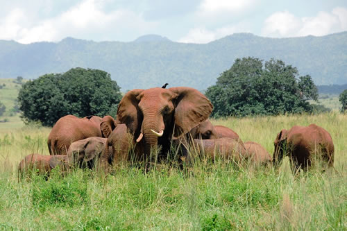
The park, which is surrounded by the jagged Rwenzori Mountains, is home to 96 different animal species, including a huge number of hippos. Among the others are elephants, lions, leopards, hyenas, and chimpanzees. The secluded Ishasha portion in the park's far south is known for its tree-climbing lions, who are the park's centerpiece.
KIBALE NATIONAL PARK
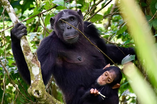 Kibale National Park is located 345 kilometers southwest of Kampala in Uganda. This deep tropical rainforest park, near Fort Portal, is one of Uganda's smallest parks, measuring only 795 square kilometers. Its highest point is 1,590m above sea level at its northernmost tip. The Albertine Rift Valley level drops to 1,100m to the south. Its varied elevation supports a wide range of ecosystems, including a wet tropical forest on the Fort Portal plateau and woodland and savanna on the rift valley floor.
Its varied flora includes 351 recognized tree species, some of which may grow to heights of more than 55 meters and can live for more than 200 years.
MURCHISON FALLS NATIONAL PARK
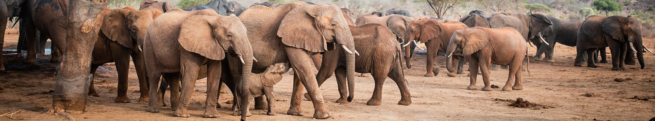
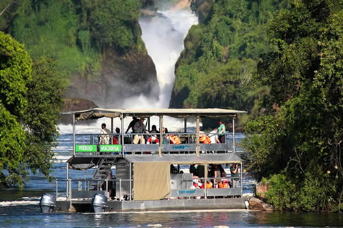 Murchison Falls National Park is not only the largest in Uganda but also one of its oldest (having been commissioned together with Queen Elizabeth National Park in 1952). The high Bunyoro escarpment meets the broad palm-dotted plains at the northern extremity of the Albertine Rift Valley.
With savanna and Borassus palms to the north, woodland, and forest to the south, and acacia trees and riverine woodlands to the north, the park's terrain is diversified. The stunning sight of Murchison Falls, on the other hand, draws visitors to this park. The Nile, which is 50 meters wide, presses through a canyon 6-8 meters wide before dropping 43 meters into Lake Albert, the "Devil's Cauldron," generating an impenetrable mist and a beautiful rainbow.
LAKE MBURO NATIONAL PARK
 Lake Mburo National Park is a 260-square-kilometer hidden treasure. Its excellent location, just south of the equator and near Mbarara town, puts it close to the freeway that links Kampala to the parks in western Uganda. The Park is a favorite weekend getaway for city dwellers and is gaining popularity on the Western safari circuit.
The park is home to 325 different bird species, including the martial eagle, red-faced barbet, papyrus yellow warbler, and African finfoot, in addition to Burchell's zebra, impala, eland, buffalo, oribi, Defassa waterbuck, leopard, hippo, hyena, topi, eland, and reedbuck. It is the only place in southern Uganda where recently reintroduced zebra and giraffe may be seen. It is also the country's sole park having impala, slender mongoose, and giant bush rats. Boat cruises on the lake are available for bird and animal observation.
RWENZORI MOUNTAINS NATIONAL PARK
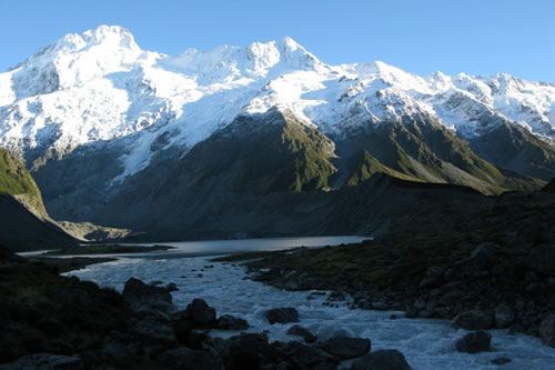 The Rwenzori Mountains, popularly known as the "Moon Mountains," is a series of mountains in western Uganda that are 260 kilometers from Kampala. Because of the persistent cloud of mist, its name means "Rain-Maker" and "Cloud-King" in the local language. The non-volcanic range stretches for approximately 110 kilometers and is 50 kilometers wide, covering an area of 996 square kilometers. It is Africa's tallest mountain range, and in 1994 it was named a UNESCO World Heritage Site for its beauty and biodiversity. Margherita (5109m), Alexandria (5083m), and Albert (5087m) are its three tallest peaks, which are all located on Mount Stanley, Africa's third-highest mountain.
MGAHINGA GORILLA NATIONAL PARK
 At an area of only 33.7 square kilometers, this is Uganda's smallest national park. The name "Gahinga" comes from a local nickname for piles of volcanic stones scraped off farmland near the volcanoes' base. The tropical rainforest stretches into neighboring countries, including Rwanda's Volcanoes National Park and the Democratic Republic of the Congo's Parc National des Virungas.
It was founded in 1991 to protect the endangered golden monkey and the rare mountain gorillas who reside in its dense forests. Because of conservation initiatives, it now boasts half of the world's mountain gorilla population.
KIDEPO VALLEY NATIONAL PARK
 Kidepo Valley National Park, approximately 700 kilometers northeast of Kampala, contains some of Uganda's most breathtaking scenery of any protected region. Flights to and from Entebbe Airport, as well as connecting flights to and from other locations, are available. The undulating, short-grass savannah of the 1,442-square-kilometer national park is flanked by mountains and broken up by rocky hills.
While it is the most remote, it is also the most beautiful park in Uganda, containing cheetahs, bat-eared foxes, aardwolves, caracals, and greater and lesser kudus. It is home to a number of major game species, as well as more than 77 mammal and 475 bird species. The park has two rivers - Kidepo and Narus - that flow during the dry season, leaving just a few pounds to feed the animals - and it is an excellent spot for game viewing.
MOUNT ELGON NATIONAL PARK
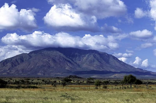 Mt. Elgon boasts the world's biggest volcanic base, covering 4,000 square kilometers. It is the oldest and largest isolated volcanic mountain in East Africa, located on the Uganda-Kenya boundary. Its massive size, reaching 80 kilometers in a circle, soars more than 3,000 meters over the surrounding plains.
Elgon is named after the Maasai name OlDoinyoIlgoon ('Breast Mountain'), and it contains five major peaks, the tallest of which is Wagagai (4,321m) on the Ugandan side. It is Uganda's second-highest peak (after Mount Stanley at 5,109m) and Africa's ninth. The fall into the enormous 40km2 caldera, rather than the last ascent to the 4,321m Wagagai Peak, is the ultimate aim of reaching Mt. Elgon's top.
SEMULIKI NATIONAL PARK
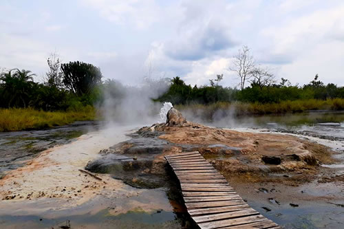 The Semuliki National Park encompasses 220 square kilometers of the Semliki Valley floor on the Rwenzori Mountains' isolated western side. The park is the only tropical lowland rainforest in East Africa and the easternmost extension of the enormous Congo Basin Ituri Forest. This forest is one of Africa's oldest and most diverse, having survived the last ice age 12-18,000 years ago.
The park contains beautiful flora and fauna. There are 53 animal species, however, sightings are restricted owing to extensive foliage, and 441 bird species, the bulk of which are real forest birds like the uncommon Sassi's Olive Greenbul Forest Ground Thrush. There are many different types of butterflies, the majority of which are Charaxes butterfly geneses. Nonetheless, it is most known for its ancient hot springs.


